Karelics Cloud release notes

Welcome to the Karelics Cloud release notes! In this document, we will share updates and changes to Karelics Cloud that have been made in the current release. These updates include new features, improvements to existing features, and bug fixes. We encourage you to review the release notes carefully to stay informed about what’s new in Karelics Cloud and how these updates may affect your use of the platform. If you have any questions or need more information, please don’t hesitate to reach out to our support team. Thank you for using Karelics Cloud!

Release 2023.11

Karelics Cloud release note 2023.11

Table of Contents

Mission management

Saving the mission to be reused

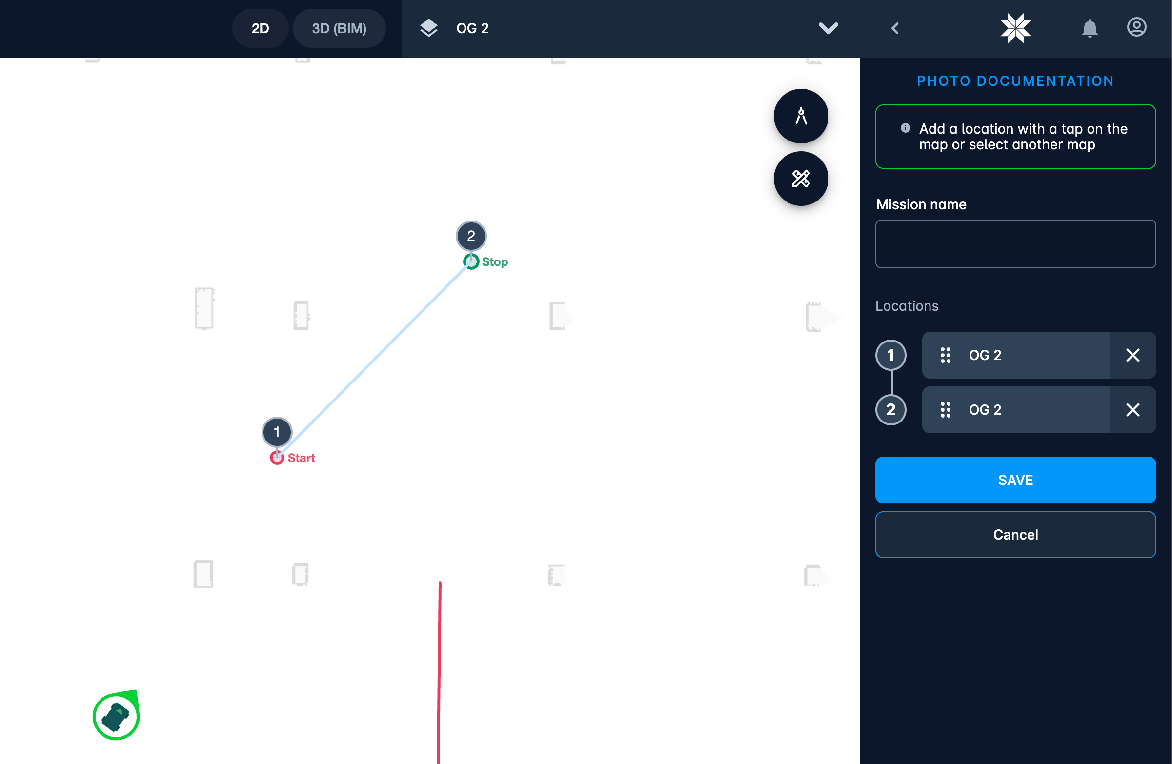
It is now possible to save the mission.

Save execution as mission

Now quick executions can be saved as a mission.

Navigation point as step in mission

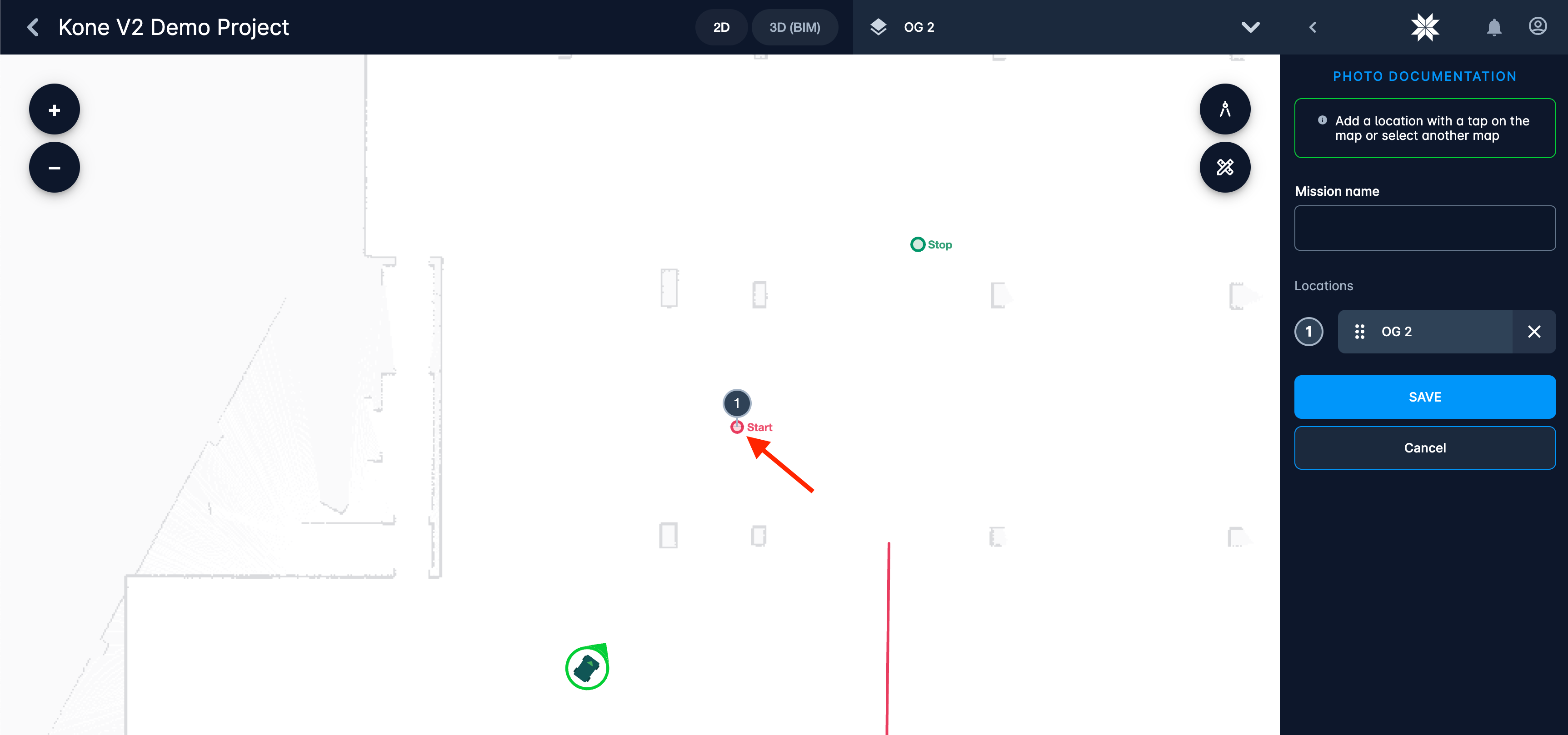
When operator clicks at navigation point – its coordinates will be taken as coordinates of the step and not the coordinates of cursor. It is especially useful when user positions the robot first → saves coordinates of robot as navigation point → and then uses this navigation point in the mission step. This way navigation can be more predictable.

Added filter to the list of mission executions

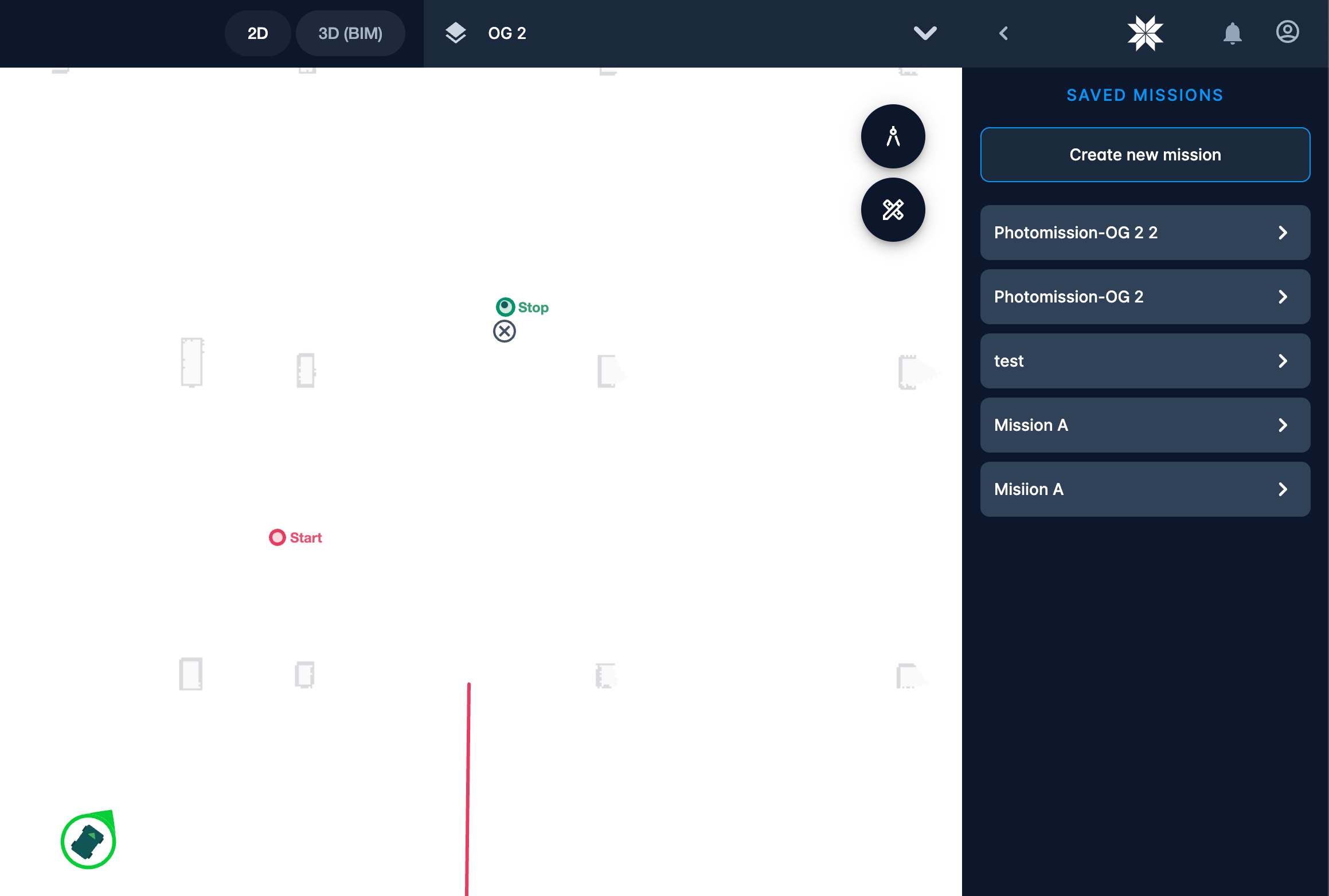
Now it is possible to see only missions from a certain status: only successful, only canceled, these that are now in progress.

Possibility to relaunch the mission

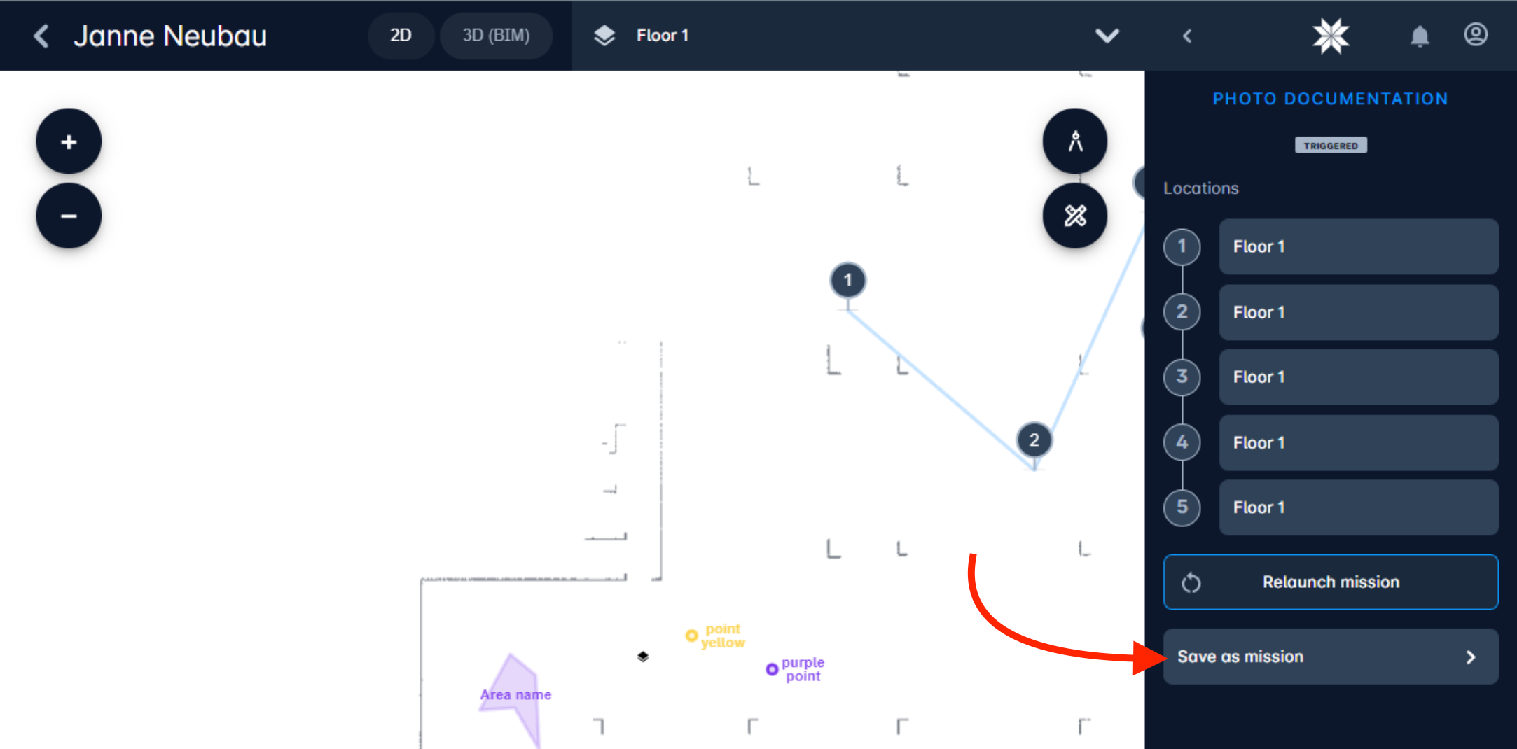
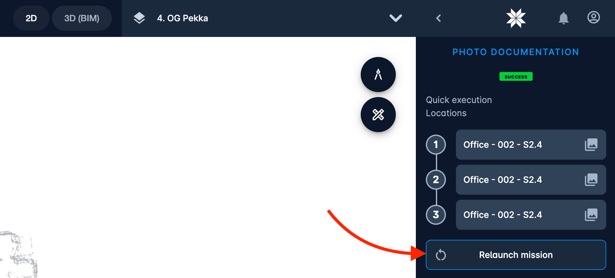
Now operators have a way to quickly relaunch the mission. Little feature but saves time a lot.

Photo documentation

Added possibility to download original file

Now operator can download the original alongside with current view.

Photo documentation improved name of downloaded file

Now downloaded photos include more relevant information for storing them properly: <project name>-<floor name>-<number of point in a mission>-<date and time>

Insta360 camera support

Now cloud supports photos done by Insta360 camera in native for it .insp format. This format helps to reduce the data transfer by up to 20% which is highly important for construction sites with unstable connection or limited internet traffic. Previously Karelics Brain had to convert the .insp to .jpg before sending it to the cloud. Now cloud will do conversion automatically itself once it receives the photo in .insp format.

Other improvements

Usability improvements

New languages support

We have added Finnish, German and Russian languages to our system!

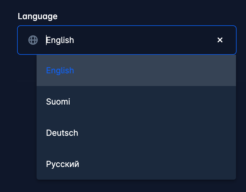
Every user can set it in his user profile. English remains the default language.
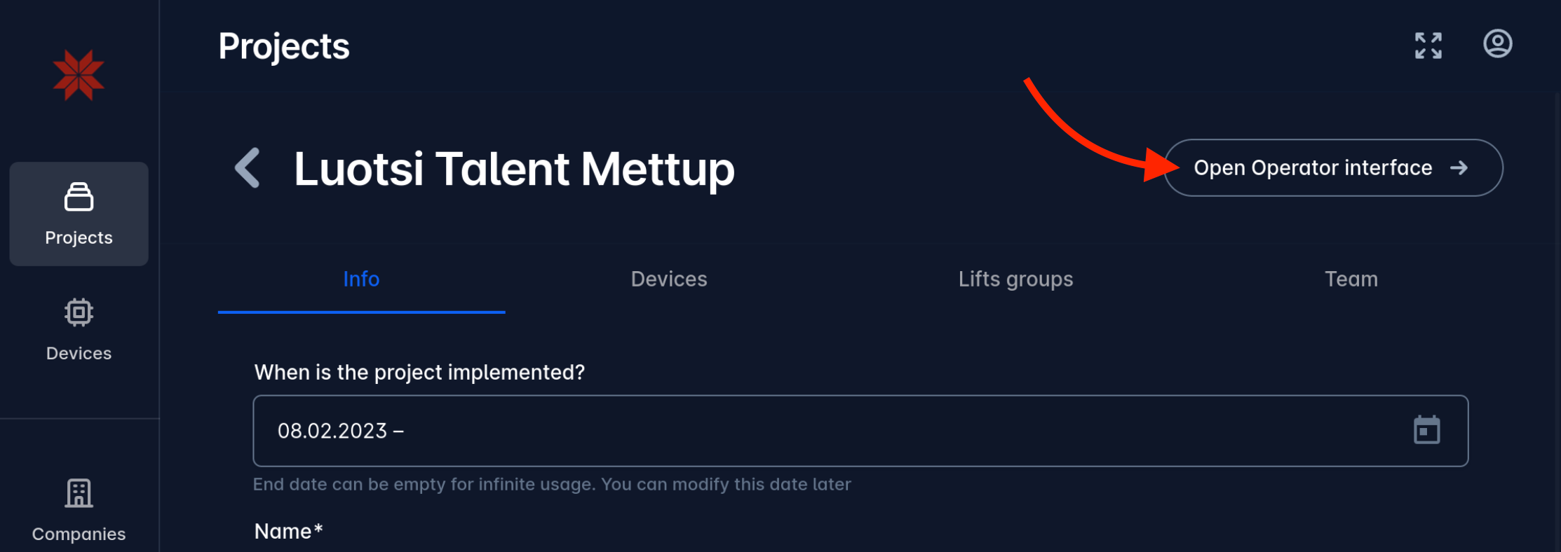
Added link to open project in operator UI
Now project configurators don’t need to search for their project by name in operator UI. There is new button to open selected project directly from configuration interface.
Showing sent tasks

Now whenever task was sent to device it will immediately appear in device sidebar. Before it has appeared only when device confirmed the receiving of the task. Now it is more clear for operators.

Fixed header for tables
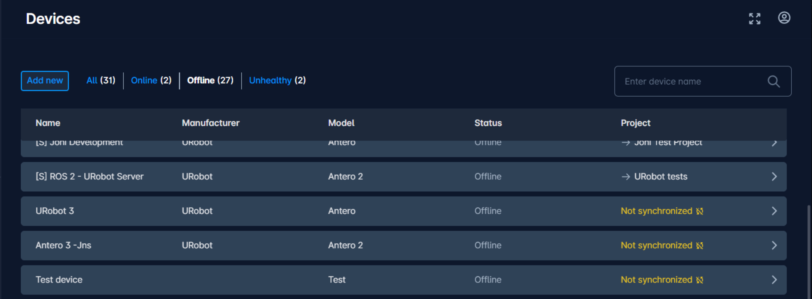
Now headers of devices and projects tables are fixed making it easier to use when the lists are big.
Improved tablet view
Improved mobile support for tablets and mobile devices. Now table will automatically switch to cards view on smaller screens. New redesigned card is more compact but shows the same amount of information. Construction project configurators can configure the project or get the overview without a need to open the laptop being on the construction site.
Improved mobile view
On mobile devices we have added the filter area on top of the list of device cards. Construction workers can filter robots by online status and by name.
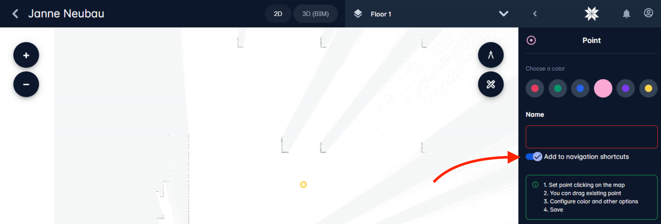
Navigation points are by default with shortcut
We have noticed that majority of points are created with shortcuts – so we have decided to eliminate one extra click.
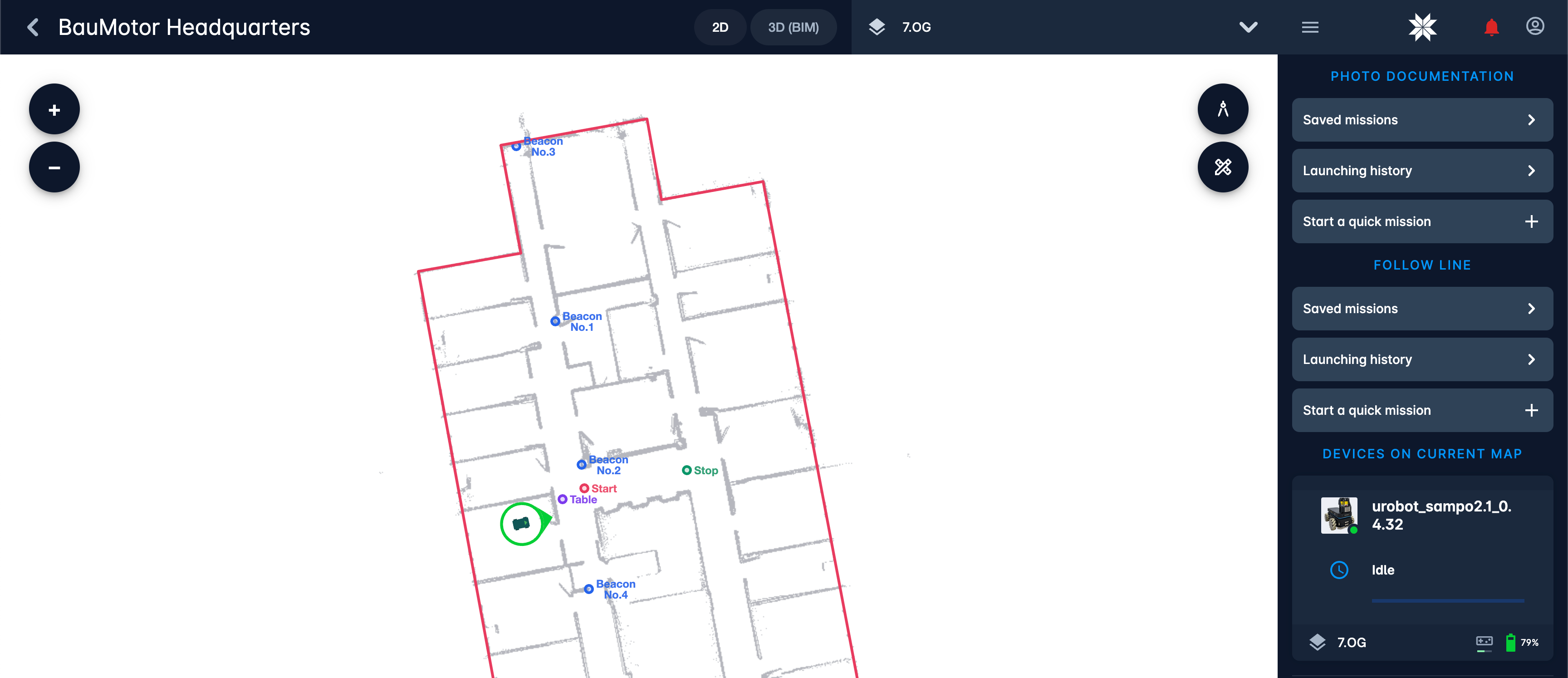
Displaying the name of point
Now we show the name of navigation points on the map.
Following device when it switches the map
When a device is selected in the right sidebar and we are on the map of that device and this device is switching the map to another map – then we will change UI to that map where this device has switched to and zoom to device.
Syncing indicator
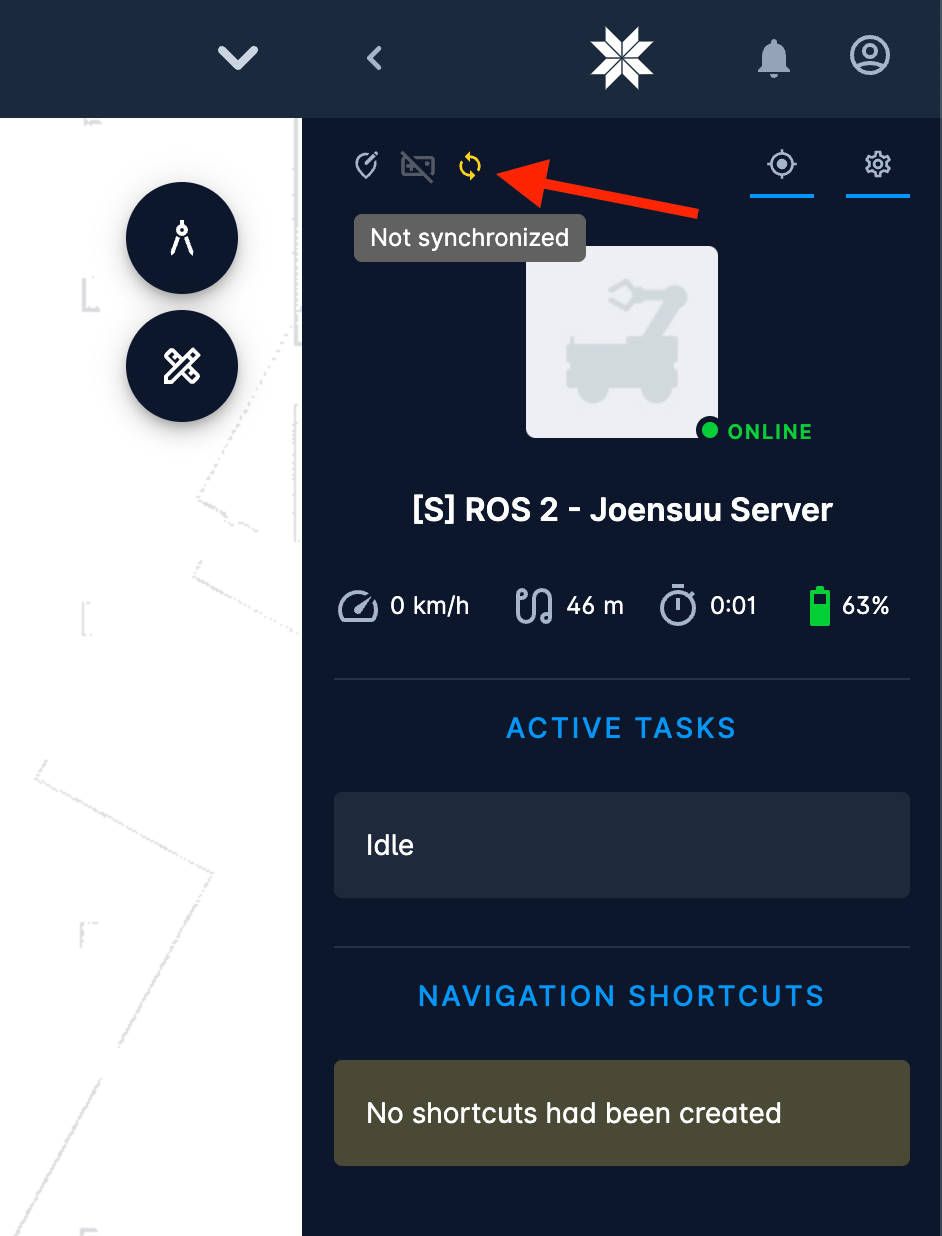
Indicator shows when device is not fully synced with cloud. Typically needs short time to be online to fully sync.
Create new floor while device is in mapping mode

Before robot operators had to position the robot → save the map → go to localisation mode → navigate in user interface to create new floor screen → create new floor.

Now we found the way to optimise this process. Creation of new floor will trigger saving of current map automatically, transparent for the end user. Now initial project configuration became more straightforward.

Stairs mode changes
Now it is not possible to save the map while robot is building the stairs map. This is a little technical limitation but helps to keep stable navigation between the floors.

Mini cloud improvements

Mini-cloud online status

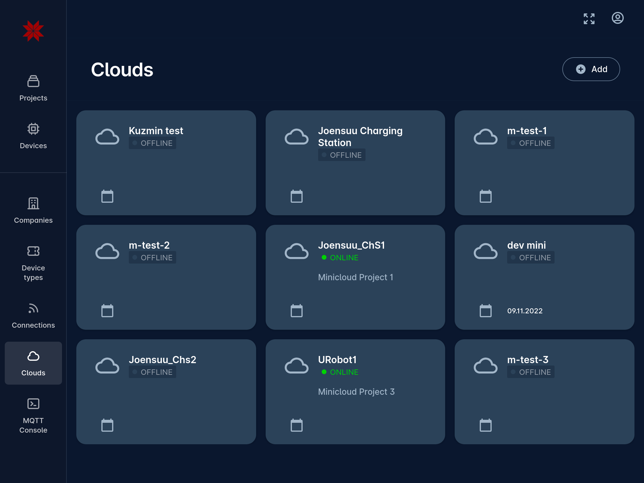
Now we show online status if the mini-cloud is connected to the main cloud.

Elevators support improvements

Highlighted the elevators if cabin is on current floor
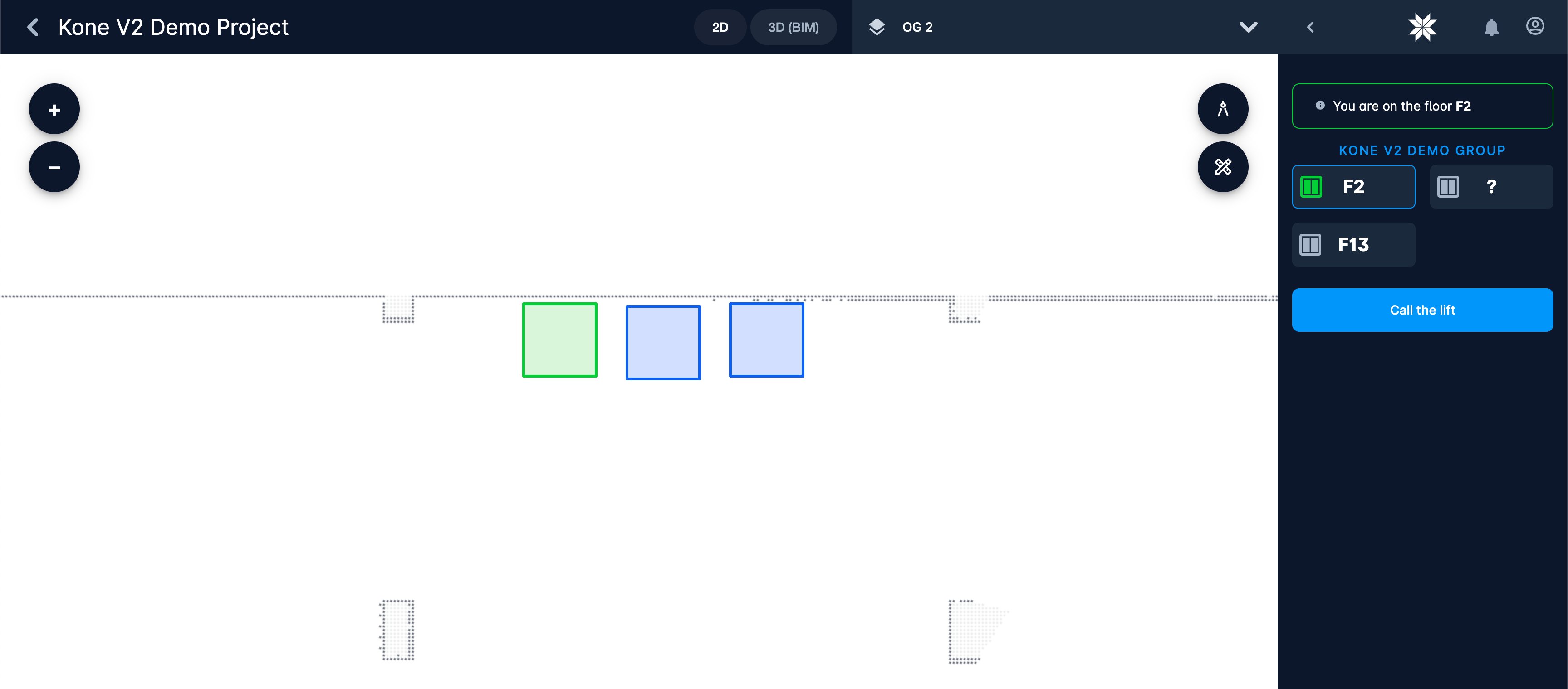
Elevator which cabin is on floor is highlighted on the map. It helps operator to see if the cabin has arrived. This happens in real time.

Elevators support improvements

  • Improved handling of maps during mapping and switching to another floor. Removed some misleading UI behaviour
  • Huge performance boost in device-to-UI sync. Now showing actual position of device is much smoother even in networks with lower latency.
  • List of mission executions now works visibly smoother

Bug fixes

  • Double click on map didn’t zoom in
  • Robot path was shown when robot task was aborted
  • Weird date format in mission executions
  • Map link was shown above the laserscan making it difficult to use in that specific situations
  • Some other bugs in handling the map and device in mapping mode
  • Huuuuuge maps were not saving after mapping…
  • Fixed go to location task
  • Device was sometimes shown in “unknown” online status
  • Various of other bugfixes that were invisible for used but important to be fixed
Stability improvements
  • Stability improvements for project data sync
  • If creation of new floor has failed – we will redirect the operator back to the previous map automatically
  • Better handling of deleted maps
  • Removed lots of unused listeners in the interface to allow more stable work in networks with lower latency
  • Some stability improvements for Mini-cloud sync
  • Improved the security settings sync to Mini-cloud. Now security changes in main cloud will be applied faster on the mini-cloud
  • Other security and stability improvements