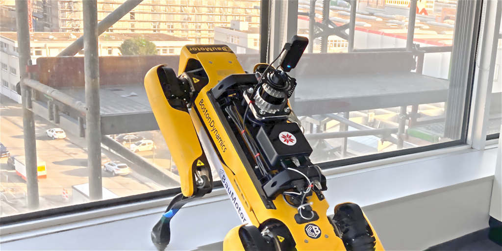
Missions: Photo documentation beta
We are thrilled to announce the new Photo documentation mission support in Karelics Cloud. Although it is currently marked as beta – it can already be used on construction sites.
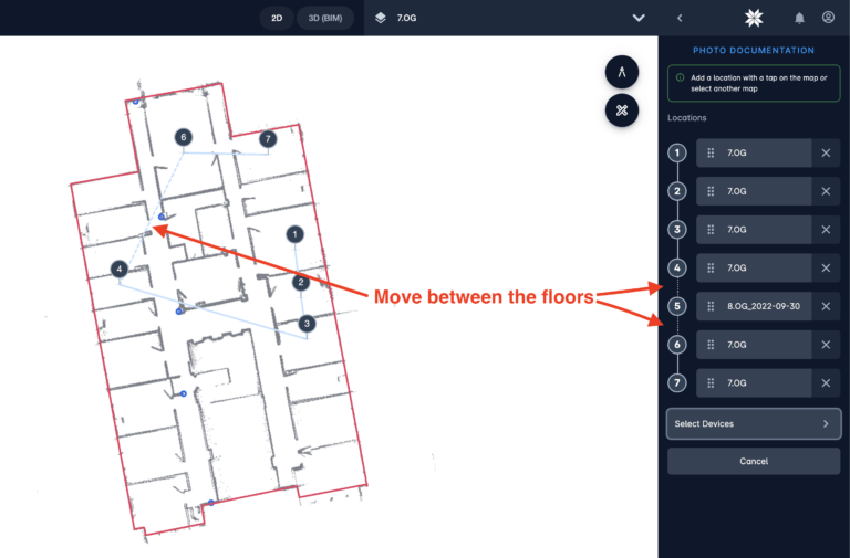
Just choose the points where the 360 photo should be taken and send the robot to do its job. Even though it is the first version, since we have multi floor navigation for robots running with Karelics Brain – operators can already choose the points on different floors and robot will find the way to autonomously navigate between them.
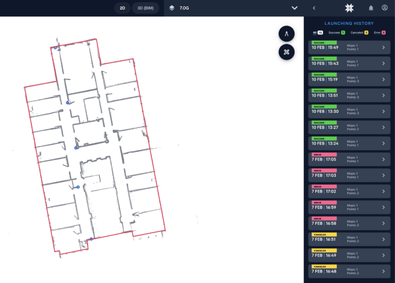
Just choose the points where the 360 photo should be taken and send the robot to do its job. Even though it is the first version, since we have multi floor navigation for robots running with Karelics Brain – operators can already choose the points on different floors and robot will find the way to autonomously navigate between them.
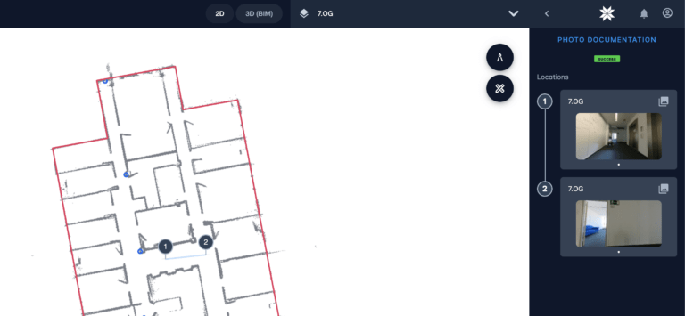
For each point operator can see the little preview of the photo. Clicking on it opens a full screen preview with possibility to zoom in and out, enter a full screen view, download current picture view and switching between pictures from different points.
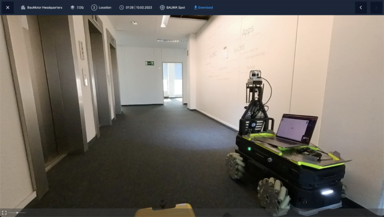
Photo documentation mission can be done by any robot running Karelics Brain, that equipped with 360 camera.
Lifts integration improvements beta
- Added support for KONE v2 API. All lifts that use API v2 are now supported by Karelics Cloud
- Added lift group status feedback in case of errors, warnings or information messages they will be shown in user interface of a corresponding group
- When clicked on elevator cabin on the map – now elevators sidebar will be opened and corresponding cabin will be highlighted. And other way around when the cabin on the sidebar is clicked – it will be centred and zoomed in on the map.

Mini-cloud improvements beta
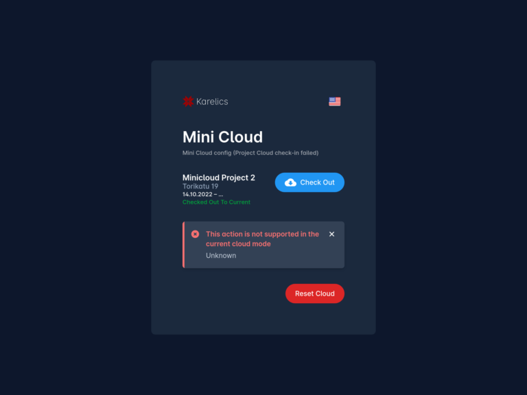
- Added possibility to reset the mini-cloud from main cloud
- Sync was expanded to some more entities to be synced
- Extended the check-out status to show the information about the current project. This simplifies the user experience
- Added user interface to manage mini cloud from main cloud
- Added better error handling on the mini-cloud, showing the related feedback messages to the user
Other improvements beta
Usability improvements
In projects list added a column with status

Now it is easier to differentiate between Upcoming, Running and Past projects. In addition we have added a new filter by project status
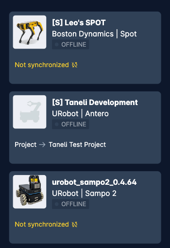
Improved list of devices

Now list of devices is present as a table with filter by name or by device online status. For smaller screens the table will be turned into cards.
Added TODAY button to calendars
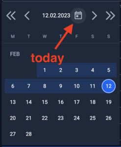
Now it is easy to quickly pick current date. Useful for projects and devices rapid planing.
Show the name of the area on the map
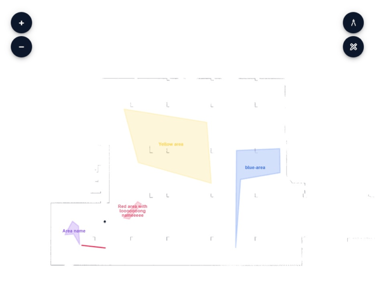
Now the name of the area will be visible on the map making it easier to use the areas in creative way and giving the operator always a clue what does this area on the map stand for.
Added corresponding icons in floors selector
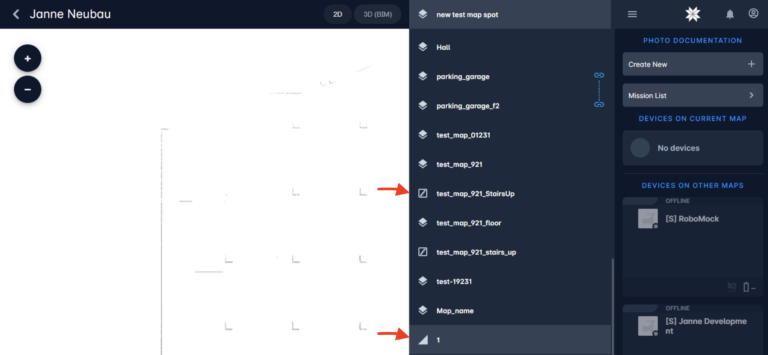
Now icons of floor types stay consistent between the creation buttons, floor selector and maplinks shown on the map.
Pack of performance improvements:
- Did big optimisation work in our operator UI to show data in more “real-time” when the internet connection is weak or unstable
- Improved the device smooth movement on the map. Now it is way more reliable in case of weak or unstable internet connection
- Improved handling of map during mapping phase
- Improved switching between maps
Pack of stability improvements:
- Some security improvements
- When by some reason creation of new floor had been canceled or completed with error – the corresponding maplinks and the map will be removed from UI. Before operator had to remove them manually that sometimes led to misunderstandings and bad data
- In some rare cases the waypoint had disappeared from the map
- Thanks for beta-testing – made some major fixes for our mini-cloud in multi-device support and some edge-case scenarios
- Found and fixed a bug in battery usage statistics. Now the calculation is correct
- Long saving of map – we know it was very annoying to wait. In fact was just a little frontend bug
- Creating of map with the same name as deleted map was not possible
- Shown time in notifications in some rare cases was wrong + added a proper message in case of error happened on creation of a new map

